
Menorca
BM92665
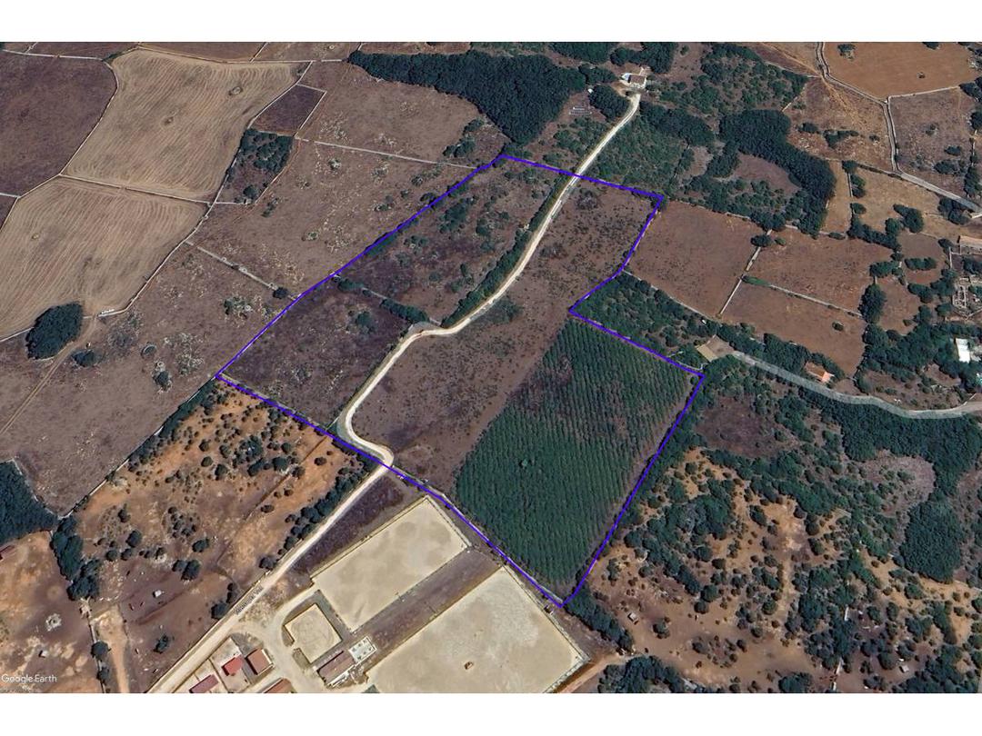
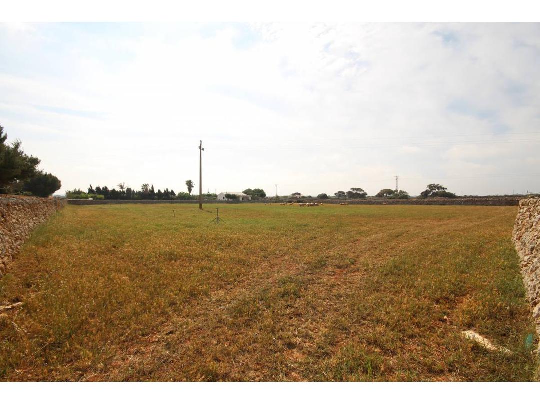
Land measuring over seventeen thousand square meters, of which 351 m2 are urban land and over sixteen thousand are rural land.
Pending confirmation by the urban planning department, the 350 m2 urban land currently used as a 90 m2 cattle-yard-style warehouse is an urban plot with a detached ground-floor building for agricultural use.
Urban Planning Regulations: General Urban Development Plan of Alaior.
(BOIB No.
83 of July 9, 1994) Urban Land A13.
Planning zone according to road alignment in an open block.
Density: 280 inhabitants/hectare and 70 dwellings/hectare.
Plots: Minimum frontage of 4 meters.
Building depth: between 8 and 20 meters, 60% of the block.
Use: Contains single-family and multi-family housing.
Comments on the implementation of the 1994 General Plan.
This regulation is subject to change when the partial plan for Alayor is shortly approved.
Grundstück mit einer Fläche von über 17.000 Quadratmetern, davon 351 m² bebautes und über 16.000 m² landwirtschaftlich genutztes Grundstück.
Vorbehaltlich der Bestätigung durch das Stadtplanungsamt handelt es sich bei dem 350 m² großen Grundstück, das derzeit als 90 m² großes Lagerhaus im Viehhofstil genutzt wird, um ein städtisches Grundstück mit einem freistehenden Erdgeschossgebäude für landwirtschaftliche Zwecke.
Bebauungsvorschriften: Allgemeiner Bebauungsplan von Alaior (BOIB Nr.
83 vom 9.
Juli 1994) Städtisches Grundstück A13.
Planungszone entsprechend der Straßenführung in einem offenen Block.
Dichte: 280 Einwohner/ha und 70 Wohnungen/ha.
Grundstücke: Mindestfrontbreite 4 m. Bebauungstiefe: 8 bis 20 m, 60 % des Blocks.
Nutzung: Enthält Ein- und Mehrfamilienhäuser.
Anmerkungen zur Umsetzung des Generalplans von 1994.
Diese Regelung kann sich ändern, wenn der Teilplan für Alayor in Kürze genehmigt wird.
Terreno de mas de diecisiete mil metros cuadrados de los cuales 351 m2 son urbanos y mas de dieciséis mil pertenecen a rustico.
A falta de confirmación por el departamento de urbanismo, los 350 m2 en urbano donde ahora existe un almacén tipo boyera de 90 m2,Parcela urbana con edificación aislada en su interior de planta baja de uso agrícola.
Normativa Urbanística: Plan General de Ordenación Urbana de Alaior.
(BOIB núm.
83 de 9 de julio de 1.994) Suelo Urbano A13.
Zona de ordenación según alineación de vial en manzana abierta.
Densidad 280 Hab/Ha.
Y 70 viviendas /Ha.
Parcelas: Frente mínimo de 4 metros.
Profundidad edificable: entre 8 y 20 metros, 60% de la manzana.
Uso: Presiente vivienda unifamiliar y plurifamiliar.
Comentarios a la aplicación del Plan General de 1994.
Esta normativa es susceptible de cambio cuando en breve se apruebe el plan parcial de Alayor.

Thinking about buying a second home or relocating to Menorca? Discover what daily life is really like, from expat commun...

Discover the 7 best areas to buy property in Menorca in 2023 with our ultimate real estate guide for foreign buyers....

If you're thinking of buying a property on Menorca, you will want to read this important information on the buying proce...